Trail Walking Les Ponts-de-Cé - Jardin - Photo
 ventana
ventana

User

© OpenStreetMap contributors
Length
Length
10.8 km
Max alt
Max alt
27 m
Uphill gradient
Uphill gradient
78 m
Km-Effort
Km-Effort  
11.8 km
Min alt
Min alt
14 m
Downhill gradient
Downhill gradient
80 m
Boucle
Boucle
Yes
Creation date :
2023-09-14 07:31:17.0
Updated on :
2023-09-14 12:53:59.238

(0 Reviews)

Walking
Walking
5h21
Difficulty : Unknown

Scan this QR Code to open this trail in the SityTrail application

FREE GPS app for hiking

Logo SityTrail SityTrail

IGN / Geographical institutes

Download SityTrail from the App Store Download SityTrail from Google Play

Logo SityTrail SityTrail World

The world is yours!

Download SityTrail from the App Store Download SityTrail from Google Play Download SityTrail on Huawei AppGallery

About

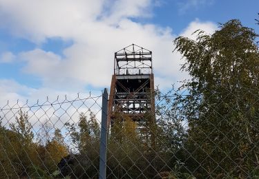
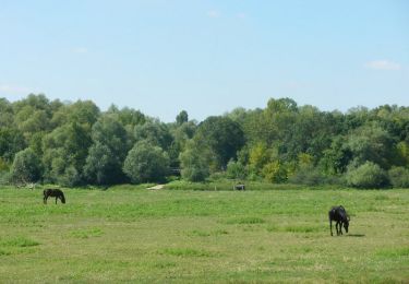
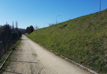
Trail Walking of 10.8 km to be discovered at Pays de la Loire, Maine-et-Loire, Les Ponts-de-Cé. This trail is proposed by ventana.

Elevation profile

Positioning

Country:
France
Region :
Pays de la Loire
Department/Province :
Maine-et-Loire
Municipality :
Les Ponts-de-Cé
Location:
Unknown
Start:(UTM)
686104 ; 5256074 (30T) N.

Trails nearby

Trail Walking Trélazé - Trélazé,  les ardoisieres  - Photo
Walking
louis49

Walking

Very easy
(1)
Trélazé, Pays de la Loire, Maine-et-Loire, France
11.8 km | 12.8 km-effort
3h 9min
Yes
Trail Walking Angers - Prairies de la Baumette et de l'île Chevrière- Sainte Gemmes sur Loire - Photo
Walking
tracegps

Walking

Medium
(1)
Angers, Pays de la Loire, Maine-et-Loire, France
10.8 km | 11.9 km-effort
2h 45min
Yes
Trail Walking Saint-Jean-de-la-Croix - St Jean de la Croix  - Photo
Walking
louis49

Walking

Very easy
Saint-Jean-de-la-Croix, Pays de la Loire, Maine-et-Loire, France
10 km | 10.8 km-effort
2h 34min
Yes
Trail Walking Trélazé - 9600177-ADAL Angers 140519M - Photo
Walking
VVerley

Walking

Medium
(1)
Trélazé, Pays de la Loire, Maine-et-Loire, France
14.6 km | 15.8 km-effort
4h 0min
Yes
Trail Walking Saint-Barthélemy-d'Anjou - Saint Barthélemy d'Anjou - Photo
Walking
louis49

Walking

Very easy
Saint-Barthélemy-d'Anjou, Pays de la Loire, Maine-et-Loire, France
10.3 km | 11.3 km-effort
2h 44min
Yes
Trail Walking Bouchemaine - Pruniers vers rocher de la Baumette. - Photo
Walking
louis49

Walking

Easy
Bouchemaine, Pays de la Loire, Maine-et-Loire, France
8.9 km | 10.6 km-effort
2h 34min
Yes
Trail Walking Sainte-Gemmes-sur-Loire - Bouchemaine chemin de Belligan  - Photo
Walking
louis49

Walking

Medium
Sainte-Gemmes-sur-Loire, Pays de la Loire, Maine-et-Loire, France
10.1 km | 11.4 km-effort
2h 25min
Yes
Trail Mountain bike Sainte-Gemmes-sur-Loire - Loire et plaine horticole - Sainte Gemmes sur Loire - Photo
Mountain bike
tracegps

Mountain bike

Easy
Sainte-Gemmes-sur-Loire, Pays de la Loire, Maine-et-Loire, France
12.6 km | 14.1 km-effort
1h 15min
Yes
Trail Walking Sainte-Gemmes-sur-Loire - Loire et plaine horticole - Sainte Gemmes sur Loire - Photo
Walking
tracegps

Walking

Medium
(1)
Sainte-Gemmes-sur-Loire, Pays de la Loire, Maine-et-Loire, France
12.6 km | 14.1 km-effort
3h 15min
Yes


Close
My subscriptions